
.jpg)
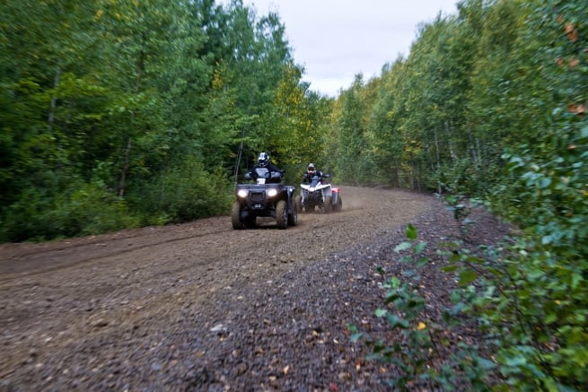
With thousands of kilometres of trails, and more being added each year, it’s no wonder Ontario is renowned as an ATV playground. Whether you’re riding a Utility, Sport or Side by Side ATV, looking for a scenic getaway for the family or a challenging new spot to test your skills, Ontario has a trail for you.
Each trail and municipality has it’s own rules and regulations so always follow the Golden Rule: “Know Before You Go.” Check with the local club to see what permits you need and make sure you’re familiar with the local by-laws regarding ATV’s on roads and crown land. Don’t trespass, stay on the trails, ride safe and have fun!
Here we’ve listed the trails for each region of the province and included the best accommodations for each area. If you have a trail that you’d like to add to the list please contact us at ian@thenewbusiness.ca.
Northeastern Ontario
Voyageur Multi-Use Trail System
Distance: 150km
Rating: Novice to Advanced
Pass/Permit: ATVO PowerPass or VMUTS
Mattawa and the surrounding townships have passed ATV-friendly by-laws allowing riders passage on local roads from their accommodations to the trailhead. The trail system is nestled between two small mountain ranges, the Algonquin Highlands and the Laurentian Mountains, and is bordered by the Mattawa and Ottawa Rivers. Offering a range of difficulty levels from easy meandering trails through majestic pines and cool valleys with clear lakes and rivers to challenging rock climbs and wet muddy areas.
West Nipissing ATV Club Trails
Pass/Permit: ATVO PowerPass or West Nipissing ATV Club Membership
The trails are mostly situated between North Bay, Temagami and Chelmsford, with some stretching as far north and west as Shining Tree and Gogama.
Bear Tracks ATV Tours
Rating: Novice to Moderate
Cochrane, Ontario‘s Bear Tracks ATV Tours, provide guided ATV tours to some remote, scenic locations throughout the area. Mostly located on crown land, you can ride all day and never be on the same trail twice. Or you can ride the streets of Cochrane and take a visit the Polar Bear Habitat & Heritage Village. To book a tour contact them atinfo@beartrackatv.com.
Recommended Accommodations:
Owl’s Nest Lodge, Alban
Happy Day Lodge, Chapleau
Elk Cabins, Elk Lake
Lake Herridge Lodge, Temagami
South River Resort, Nipissing
Mattawa Adventure Camp, Mattawa
Algoma Country
Elliot Lake has over 300km of some of the most exciting trails in the province. The plans were well thought out—all the trails are loops making it so you’re never more than 20 minutes from any services or amenities you’d need. A great destination for riders of all ages, whether seasoned or novice and perfect for day trips, overnight stays or extended 3 to 5 day excursions. For more information contact the ATVO or the Elliot Lake ATV Club.
The Boardwalk Run
Distance: 41km
Rating: Easy/Moderate with short section of avoidable Moderate/Advanced
Pass/Permit: ATVO PowerPass
The club’s first trail includes a variety of terrain with scenic views across Home Lake and Scenic Lake. Wrapping around the city, it is the main loop that connects with the Boreal Forest Run and the Portage Run. Most of it is easy to moderate with short and avoidable portions that require riders with more experience.
Distance: 47km
Rating: Easy to Moderate
Pass/Permit: ATVO PowerPass
Expansive views of this open powerline trail make this a favourite for ATVers and Snowmobilers. Leads to old growth forest full of wildflowers in the summer and vivid yellows from birch trees in the fall. Connects to the Portage Run or the Boardwalk Run or back to the city.
Distance: 60km
Rating: Moderate
Pass/Permit: ATVO PowerPass
The first and possibly only trail in Ontario built by an ATV club for shared use with snowmobiles is a really scenic one with a backdrop of rock cliffs, bridges over remote lakes and great views of the city. The route travels Stanrock Road for an extent, providing a glimpse of Elliot Lake’s modern lakefront development project. The trail can also be extended to Whiskey Lake for a real distant adventure.
Distance: 49km
Rating: Advanced
Pass/Permit: ATVO PowerPass
This looped trail is renowned for a challenging ATV ride through rough, muddy and rocky sections of trail and is recommended for advanced riders with four wheel drive ATVs. Sections of trail are open depending on season, water and weather conditions.
This route is an extension of the Boreal Forest Run or the Boardwalk Run. The destination is a fantastic view of Lake Matinenda. The ride passes through tight, muddy trails and along some great sections above Quimby Lake.
Distance: 6km
Rating: Novice
Just barely outside of the City of Elliot Lake, this multi-use trail offers some spectacular views.
Recommended Accommodations:
Northern Walleye Lodge, Missanabie
Murray Lake Lodge, Murray Lake
Northwest Ontario
Nipigon Bay Snowmobile Club Trails
Distance: 200km
Rating: Novice to Moderate
With trails crossing private and crown land. Trail use is used exclusively by snowmobiles during winter months, from October 31st to April 31st.
Distance: 8km
Rating: Novice
This trail is used by pedestrians, cyclists and rollerbladers. It’s a 6 foot wide asphalt path designed for use by everyone.
Rating: Intermediate to Advanced
There are a number of remote trails in this already remote part of the province. There can be very muddy bog sections in the spring.
Hillock and Highwinds Lake Area
Rating: Novice to Advanced
There are plenty of remote trails in the area. Most of them are not maintained so be prepared to clear the trails of downed trees or other obstacles. Some areas can get pretty boggy and are recommended for experienced riders. Best to go in with a group or at least not alone as this is the real wilds of Ontario. There are trails that lead right out to the Trans-Canada making it easy to connect with the trails in the Vermillion Bay area.
Distance: 15km
Rating: Novice to Advanced
North of Kenora, almost at the Manitoba border are a series of trails ranging in difficulty. Parts are single track and quite narrow, most of it is very rocky and all of it is scenic and remote. The trails extend down to the lakes so it’s good for swimming, camping and fishing. From this area you can ride ATV trails all the way to Vermillion Bay!
Recommnended Accommodations:
Birch Dale Lodge, Eagle Lake
Explorers’ Edge
Distance: 230km
Pass/Permit: ATVO PowerPass or Park to Park Trail Pass
The main system in the Parry Sound-Georgian Bay area is the Park-to-Park multi-use trail system. This exciting route from Killbear to Algonquin Park is set within a natural paradise of lakes, forests, beaches, and the 2.5 billion-year-old granite of the Canadian Shield. The following is a list of trails within the Park to Park system:
Distance: 80km
Rating: Moderate
Pass/Permit: ATVO PowerPass or Park to Park Trail Pass
The best known section of the Park to Park trail network. Following the historic route of the Ottawa, Arnprior & Parry Sound Railway (later part of the Canada Atlantic Railway) built by J.R. Booth, this section of trail stretches from just west of Highway 400 to the Wall’s Junction where the trail splits. This section of trail is one of the more adventurous segment, with a rough, dirt surfacing and the occasional puddle.
Best spot for parking is at the Georgian Bay Travel Centre, there is a large, paved parking lot with lots of room for trailers and an off-road ramp that connects the PetroCan to the trail. In Sprucedale, food and gas are accessible on the trail.Click here for more information including detailed trail maps.
Pass/Permit: ATVO PowerPass, Park to Park Trail Pass or Algonquin West ATV Club
This section is the continuation of the Seguin Trail past the Walls Split. Passing under Highway 11 and traveling through the town of Kearney to the Algonquin Park boundary this section has a diversity of trail types, from retired rail bed, road and dirt track. The Old Bethune Trail is shared with our partner the Algonquin West ATV Club. This section of trail is currently is managed by the Ontario Ministry of Natural Resources.
Pass/Permit: ATVO PowerPass or Park to Park Trail Pass
Heading south, first on dirt road then on off-road trail, Settler’s Trail provides incredible views of Highway 11 and access to Huntsville. For motorized users this is the end of the route as currently ATVs are not permitted on the roads in Muskoka.
Distance: 15km
Pass/Permit: ATVO PowerPass or Park to Park Trail Pass
Rolling single-track style trail following the original Shawnaga Colonization Road between Carling Station and the Dillon Road. Maintained by Carling Township. Trailheads include small parking lots that can accommodate vehicles with trailers.
Distance: 5km
Rating: Novice
Pass/Permit: ATVO PowerPass or Park to Park Trail Pass
From the trailheads at Nobel School just south of Avro Aero Blvd or from the McDougall Township office head west on a gravel motorized (ATV and snowmobile) trail to the west. This section of trail is owned and maintained by the Township of McDougall.
Distance: 8km
Pass/Permit: ATVO PowerPass or Park to Park Trail Pass
This trail follows the final segment of J.R. Booth’s railroad. This historic route connects Rose Point, where a bridge passes over to Wasauksing First Nation and Depot Harbour, the terminus for the railroad, to Forest Hill, adjacent to Oastler Provincial Park. This trail, which saw a major overhaul in 2010/2011 is a great location to spot turtles in the many wetlands that line the trail. This section of trail is owned by Seguin Township and managed by the Park to Park Trail Association. Cargill Road has a large parking area that will fit 20+ vehicles including trailers. Access the Cargill road parking area to the west of Oastler Park Drive across from Kropf Industrial on Cargill Road.
Distance: 14km
Rating: Novice
A flat multi-use rail trail near Oxtongue Lake with many beautiful lakes and wetlands in the south section and heavily forested areas in the north that can become particularly wet in the spring or after a heavy rain.
Distance: 42km
Rating: Novice to Moderate
A multi-use rail trail of mostly gravel near Magnetewan. Lots of scenic views as well as opportunities for fishing, swimming and photography. The trail is remote with the closest services being in Kearney.
Distance: 70km
Rating: Novice
Located near Magnetewan, the Old Nipissing Road was once a colony road utilized by early settlers in the area. ATV travel along this route is allowed on the designated trail only.
Distance: 1000 acres
Rating: Novice to Moderate
Seguin, Ontario’s Bear Claw Tours, provide guided ATV tours to some remote, scenic locations throughout the area. Offering a rider course for first-time riders for ages 6 and up, this is an ideal place to get some hands-on experience on an ATV in Ontario’s north.
Recommended Accommodations:
Bayview Wildwood Resort, Severn Bridge
Northridge Inn & Resort, Sundridge
Bruce Grey Simcoe
Baxter/Severn ATV Trail Riders Trails
Distance: 90km
Pass/Permit: OFATV / Baxter/Severn ATV Trail Riders
With trails just east of Georgian Bay including a great loop that will take you from Baxter Lake through the many lakes of the area south to Coldwater and back north to Port Severn. There are great mudholes, water and technical rocks around Barron’s Lake.
Central Ontario ATV Club Trails
Distance: 60km
Rating: Novice to Advanced
Pass/Permit: OFATV
Currently maintaining 4 loops in the areas just South and East of Georgian Bay. Take in the amazing scenery along the bush trail located in various Simcoe County Forests that vary from smooth and sandy to tricky and technical.
Distance: 267km
Pass/Permit: OFATV / EOTA available locally at these locations.
Most trails are located in Grey County with some stretching down into Dufferin County near Shelburne.
Below is a list of maps for DGATV trails:
Distance: 80km
Rating: Novice
A multi-use trail running from Port Elgin to the Bruce-Huron Line and from Port Elgin to Bruce Road 33 near Kincardine. The scenic trail has been signed and gated and some upgrades to the trail surface have been completed. Most of the rail trail surface is made up of a mixture of soil and coarse aggregate.
Distance: 77km
Rating: Novice
The CP Rail Trail runs from Owen Sound to Dundalk and is open to ATV from May 1st to November 30th. The Dufferin Grey ATV Club trails exit of this trail, making a great connection to tour the countryside through Beaver Valley and Chatsworth. Access to food and gas in Markdale and Chatsworth. Parking at 120 Sideroad and Markdale (with toilets!) and in Dundalk right on the trail.
Distance: 22km
Rating: Novice
Pass/Permit: EOTA / OFATV and Tiny Trail ATV Permit
A multi-use rail trail about 40km north of Barrie open to ATVs from April 30th to November 30th. It accesses the Tiny Marsh Wildlife Area and 10km to the west, some of the longest freshwater sand beaches in North America and the Ossossane Bone Pit, an ancient site of Huron/Wendat mass burials. Parking is available at Wyevale and Perkingsfield (Bernie LeCliar Park).
Recommended Accommodations:
Horseshoe Resort, Barrie
Ontario’s Highlands
Distance: 690km
Pass/Permit: OFATV / EOTA or OVATVC (available at club meetings or from membership director)
The OVATVC riding area is nestled in the beautiful Madawaska Highlands of Eastern Ontario. The trails cover a large area which is generally bordered by Calabogie to the north east, Sharbot Lake to the south, Bancroft to the west and the Madawaska River to the north.
Kaladar Trail—Trans Canada Trail Section
Distance: 17km
Rating: Novice
Kaladar is a small community located in Lennox and Addington County. This multi-use part of the Trans Canada trail is part of the Eastern Ontario Trail Alliance and there is user pay. It is part of the CP rail corridor, links westerly to Tweed and Havelock and easterly to Sharbot Lake and Glen Tray.
Renfrew County ATV Club Trails
Distance: 700km
Rating: Novice to Advanced
Pass/Permit: EOTA / OFATV or RCATV membership
Located in the Ottawa Valley, the 700+ kilometre network of trails is built on a foundation of abandoned rail lines and forest access roads that meander through forests, lakes view vistas and remarkable Ontario landscapes. This adventurous route winds it’s way across the countryside passing through numerous rural commnunities that provide riders with convenient access to a wide variety of supplies, services and accommodations.
Thomas P. Murray Recreational Trails
Distance: 20km
Rating: Novice to Moderate
A combination of multi-use trails situated in and amongst Barry’s Bay famous for it’s natural beauty and scenic outlooks.
Distance: 35km
Rating: Novice
The trail extends from the community of Haliburton to the community of Kinmount. The scenery along the way is exceptional, with lazy winding rivers, waterfalls, bogs, heritage bridges and even the ruins of a chemical plant. At Kinmount the trail continues for an additional 55km as the Victoria Rail Trail. This extends to the community of Lindsay, and from there another rail trail connects to the City of Peterborough.
Recommended Accommodations:
Sandy Lane Resort, Minden
Morning Mist Resort, Stonecliffe
Ottawa and Countryside
ATV Club of Eastern Ontario Trails
Distance: 329km
The ATVCEO has a series of trails located in the countryside east of Ottawa, from just east of Casselman to Alexandria and north to the Ottawa River. As a result of recent by-law changes, the ATVCEO and Nationa Valley ATV Club are now linked.
Southeastern Ontario
Distance: 40km
Rating: Intermediate to Advanced
Pass/Permit: OFATV / EOTA. To learn more about membership click here.
View a map of the trails and locations to buy passes here or a pocket map here.
Distance: 100km
Pass/Permit: OFATV / EOTA. Click here for membership information.
Located just south of Ottawa with trails near Winchester, Hallville and South Mountain. View a google map of the trailshere or the OFATV/NVATV interactive map here.
Pass/Permit: OFATV / EOTA or FATV Membership
Membership to the FATV gets you access to the following trail systems: EOTA Network, Trillium Trails Network, OFATV Trails and the Province of Quebec Trail System.
Recommended Accommodations:
White Rock Motel, Alexandria
Peterborough, Kawartha Lakes & Northumberland
Distance: 156km
Rating: Novice
The Hastings Heritage Trail is a four-seasons, multi-use recreational trail that follows an old railway line linking Hastings County. The trail is open year-round and boasts a number of parking lots and access points along the route. Trails in Hastings County consist of a 156-km ribbon of land stretching from Glen Ross to Lake St. Peter, connecting them to the waterways of the Trent Canal System in the south and the edge of Algonquin Park in the north. With points-of-interest like waterfalls, ghost towns and the historic Hogan’s Hotel, this is a great trail for a leisurely ride or family outing.
Distance: 300km
Rating: Novice
Pass/Permit: Ganaraska Forest Membership or Day Pass
Southern Ontario’s largest forest is located just an hour’s drive from Toronto. With hundreds of kilometres of trails and logging roads, easy parking and multiple entry points. ATVing is permitted in the West Forest and East Forest only. The Central section of the Forest is maintained as a passive use area. Go to the Durham Region ATV Safety Coaltion site for locations for annual and day use permits other imporant information before heading out.
Distance: 85km
Rating: Novice
Pass/Permit: EOTA / OFATV or Kawartha Lakes ATV
A multi-use trail managed by the County of Victoria, the trail follows the former CN rail line which was constructed beginning in 1874. The trail takes you from Lindsay along Sturgeon Lake to Fenelon Falls. From Fenelon Falls it’s on to Cameron Lake. During the summer months the bridge crossing this waterway is swung open to allow boater traffic through. Therefore it is necessary to detour through the downtown and along highway 121. At the north end of Cameron Lake the trail follows the Burnt River north eventually leading to Kinmount. The trip from Fenelon Falls north to Kinmount is 32km and is especially scenic with areas that look like they’ve never been touched by man at all (besides the trail of course!). From Fenelon Falls to Lindsay is 22km and then it’s another 10km to the community of Cameron. The trail continues on toward Ken Reid Conservation Area and eventually on to Lindsay where ATVs are not permitted on the trail.
Recommended Accommodations:
Beachwood Resort, Selwyn
Huron, Perth, Waterloo and Wellington
Pass/Permit: OFATV / EOTA available locally at these locations.
Distance: 10km
Rating: Moderate
This trail system consists of winding flat trails, with some hilly areas and Blue Arrow trails (ie challenging muddy sections). It can take 1.5 to 3 hours to run. It is side by side friendly up to 64” width. This system is generally open for winter riding. Check website for updates.
Recommended Accommodations:
Forest Motel and Woodland Retreat, Stratford
Hamilton, Halton and Brant
Pass/Permit: OFATV / EOTA available locally at these locations.
Cathcart Trail System
Distance: 12km
Rating: Novice
This trail IS NOT side by side friendly at present.This trail system has 12 km of family friendly trails, with some blue arrow trails. It will take 1.5 to 3 hours to run. Watch signs, as a couple trails are one way only. Bring a lunch to enjoy at our picnic area over Redneck Bridge.
Recommended Accommodations:
Comfort Inn Brantford, Brantford
Niagara
Currently in the Niagara Region you can legally ride your ATV on your own property, private property with permission from the land owner, crown land and on Quad Niagara/ OFATV legal trail system.
Recommended Accommodations:
Canadas Best Value Inn, Port Colborne
York, Durham and the Hills of Headwaters
Distance: 267km
Pass/Permit: OFATV / EOTA available locally at these locations.
Most trails are located in Grey County with some stretching down into Dufferin County near Shelburne.
Below is a list of maps for DGATV trails:
Distance: 300km
Rating: Novice
Pass/Permit: Ganaraska Forest Membership or Day Pass
Southern Ontario’s largest forest is located just an hour’s drive from Toronto. With hundreds of kilometres of trails and logging roads, easy parking and multiple entry points. ATVing is permitted in the West Forest and East Forest only. The Central section of the Forest is maintained as a passive use area. Consult the Durham Region ATV Safety Coaltion for permit sale locations and safety information before heading out.
Recommended Accommodations:
Holiday Inn Express Hotel and Suites, Clarington-Bowmanville
Ontario’s Southwest
Norfolk County ATV Club Trails
Rating: Novice
B&D ATV Trails is a family park located in beautiful Six Nations of the Grand River Territory on 70 acres of grass and wood trails. The trail systems provide riders with freedom and a chance to explore a majestic Carolinian Forest. A great place for a family outing.
Haldimand Area ATV Club Trails
Distance: 40km
Pass/Permit: OFATV / EOTA. To learn more click here.
Morton Terminal
This is multi-use trail area just off of Ojibway Parkway in Windsor. ATV’s are only allowed on the main path and area around the tracks.
Recommended Accommodations:
Howard Johnson, Tillsonburg

